
Trace a Conway Street by Address
A Conway street search works best as a property trail. Horry County Tax Payer Services supplies the main property-search doorway. The county GIS places the tax parcel. City GIS adds municipal address, centerline, permit, and city-limit context. The Horry County Register of Deeds then connects a confirmed legal description to recorded instruments. Each step answers a narrower question than the last. The result is a better way to understand a parcel than treating an address as a ready-made list of people.
- Confirm the supplied street spelling against the City GIS address and centerline layers, then check the current city-limit layer if the Conway mailing label may be misleading.
- Search Horry County Tax Payer Services with the address. Preserve the PIN or TMS and any legal-description detail available after account access.
- Use the authorized Horry County GIS parcel service to position the tax parcel. Its parcel fabric is for taxing purposes, not a boundary survey.
- Search Horry County Records Search by legal description, party name, book and page, or record date as the available lead supports. Match the lot or subdivision before following a prior party.
- For a city building or utility lead, use the City of Conway public-record search by address, parcel number, name, or building record number. Keep a permit finding separate from any claim about current occupancy.
MySCVOTES is not a street-browse tool. Its registration check is personalized and requires the voter’s name, county, and date of birth as shown on the registration card. A defined election-record question belongs with the state or Horry County elections custodian, not an address-wide lookup.
Note: Record the exact address, PIN or TMS, legal description, and source date before moving from one Conway record system to another.
Conway Street Tax Search Keys
The visible Horry property control is labeled Name or Pin or Address. That wording matters. A PIN is a county locator, while a street address is a practical starting point and a name may be only one search key. The same tax page also has returned-assessment, returned-notice, unclaimed-funds, and stormwater-refund searches. Those are separate databases, so they should not be treated as proof of ownership, residence, or an address match.
| Visible tax-page field | Type | Needed | Conway street use |
|---|---|---|---|
| Name or Pin or Address | Text search | One key | Main property and tax-search route. |
| Undeliverable Assessments | Name or PIN | One key | Separate returned-assessment database. |
| Undeliverable Notices | Name or PIN | One key | Separate returned-notice database. |
| Unclaimed Funds to State | Name or Receipt Number | One key | Refund route, not a property record. |
| Stormwater Checks | Name or Pin or Address | One key | Separate refund-search route. |
Horry County began requiring a free user login on March 16, 2026, for online GIS, Land Records, and Tax and Assessor platforms that display property-address information. The public source did not expose an authenticated parcel-result schema. For that reason, this address resource does not promise a particular owner, mailing, valuation, transfer, or exemption field on a live result. Inspect the current record, then ask the county office about a needed copy or correction.
The Tax Payer Services search screen shows the county’s unified property-search label before access to address-bearing records.
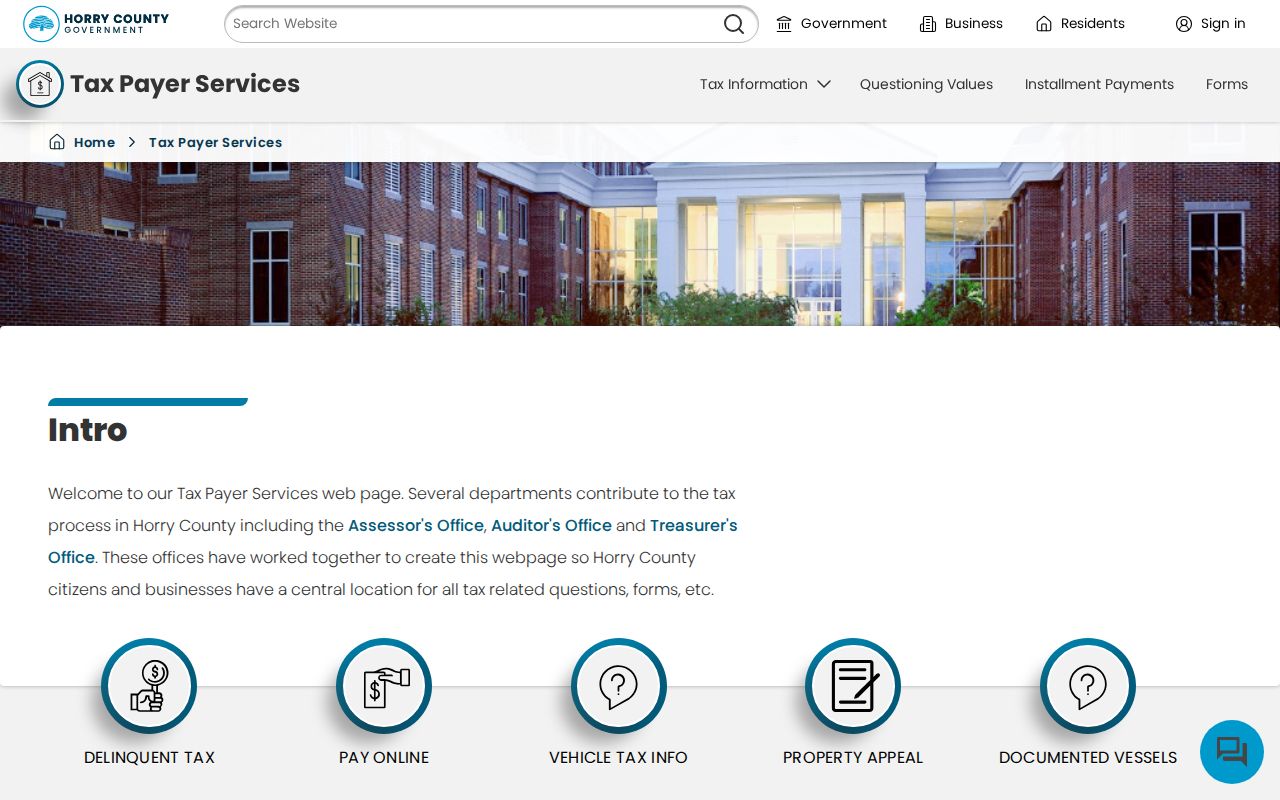
Use that one-key search to establish a parcel lead, then compare it with the deed and GIS records instead of treating it as a person list.
Conway Street GIS Context
County and city GIS serve different roles in a Conway address search. The county application represents the tax parcel fabric and warns that it is not a survey. The county’s retrieved login screen showed a username, password, sign-in, registration, and account-recovery controls. It did not document an adjacent-parcel button, a whole-street query, a buffer tool, or a parcel-result popup. Use the map to place and compare a selected tax parcel, not to claim that the application publishes an automatic street roster.
The Horry County GIS account screen is the route for authorized parcel access.
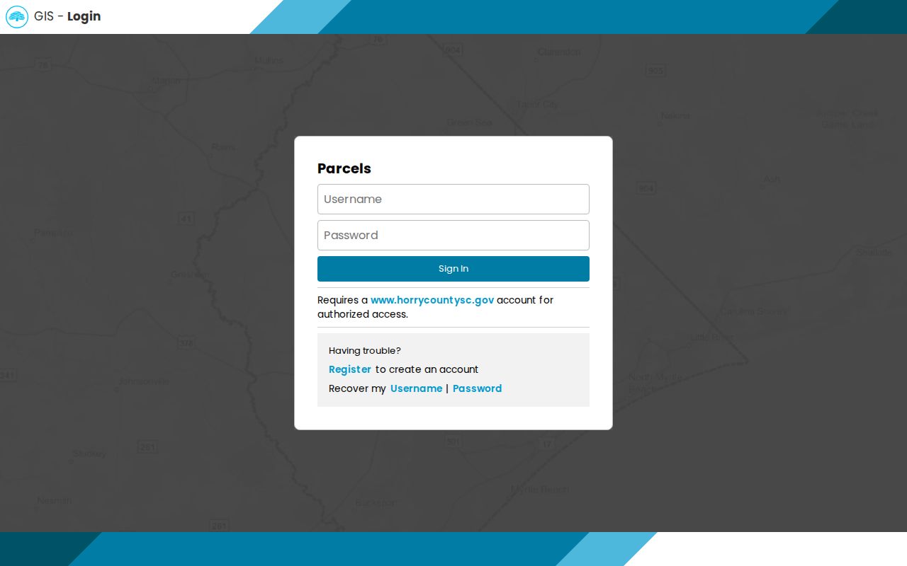
Its login requirement complements the March 2026 account change that affects county platforms showing property addresses.
For municipal context, the public City of Conway GIS service identifies City Addresses, PERMITS, CENTERLINES, CURRENT_CITY_LIMITS, zoning, easements, flood zones, buildings, and other layers. A centerline helps resolve a road spelling or alignment. Current city limits help separate a city inquiry from a surrounding Horry County address with a Conway mailing label. These map layers add location context, not title or occupancy proof.
The city’s published layer list makes the available address, permit, centerline, and city-limit records visible.
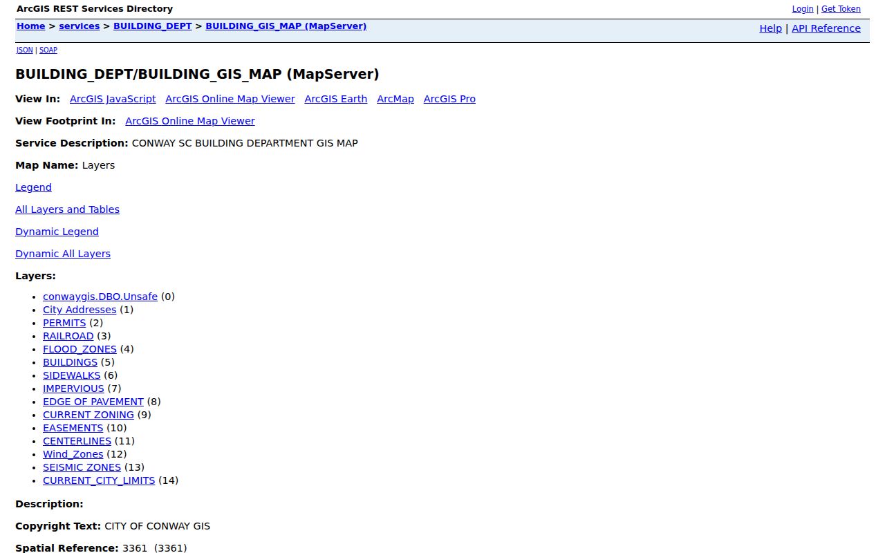
Compare the municipal layers with the county tax parcel before deciding which Conway or Horry custodian should receive a focused record request.
Deeds Along Conway Streets
Horry County Records Search is indexed around recorded-document keys, not a promise of a street-address search. Its Official Records Search offers Name, Book/Page, New Legal Description, Legal Description/Memo, Document Type, Consideration, and Record Date modes. Name mode is for grantor and grantee parties. A legal description identifies a recorded lot, subdivision, or other property description. It is often the bridge between a street address and a historical instrument.
- Parcel
- A tax-geography unit used by the county to identify property for taxation.
- Situs address
- The physical location of the taxed parcel. It can differ from an address used for correspondence.
- Plat
- A recorded map of property or subdivision detail. It is a better boundary source than a tax map when the question is a line or lot.
- Grantor and grantee
- The parties used in a recorded transfer trail. Match their document to the legal description, not just a similar address.
The official copy form says online name results reach 1984 forward and directs the requested party format as last name, first name, with no punctuation. For an older chain, use the Register’s counter or copy request, South Carolina Archives county microfilm, or the FamilySearch catalog route for historic Horry materials. Do not infer a particular older volume year when the custodian has not confirmed it.
The Official Records Search landing page displays the documented browse modes that help switch from a name lead to a legal-description or book-and-page lead.
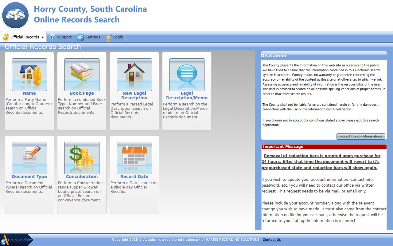
Moving between those keys is safer than assuming every recorded document can be found from a street name alone.
Conway Street Deed Copy Costs
When an index lead needs a copy, the Register of Deeds offers a defined offline path. Its mail request asks for the name on the document and document type, plus as much available locator detail as possible: book and page, TMS or PIN, property address, and a brief property description. A requester can select a normal or certified legal copy and provide a phone number for clarification. That redundancy is useful when two Conway parcels or party names are similar.
The verified charge for a normal copy is $8 for the first four pages and $1 for each additional page. A certified legal copy adds $2. Small plats cost $5 and large plats cost $10. Mail requests go to Register of Deeds, P.O. Box 470, Conway, SC 29528, with payment by check or money order payable to Register of Deeds. The form does not give a turnaround estimate, so no timing is assumed here.
Call 843-915-5430 to confirm page count or get help with a selected instrument. The Register’s physical office is at 1301 Second Avenue, Conway, SC 29526, open Monday through Friday from 8:00 a.m. to 4:45 p.m. This is the practical fallback when the online index points to a document but account access or an image is unavailable.
Note: A recorded deed establishes an instrument and named parties, while the property’s present use requires separate, current verification.
Conway Street Permit Searches
City of Conway Public Records Search exposes All Records, Building Department, and Utility Billing categories. One search key is required for each visible mode. Address, Name, and Parcel Number search the building-department and utility-billing categories. Record Number is a Building Department route. Choose the narrowest category that matches the property question, then confirm any record with the city department.
| City search mode | Verified scope |
|---|---|
| Address | Building Department and Utility Billing search mode. |
| Name | Building Department and Utility Billing search mode. |
| Parcel Number | Building Department and Utility Billing search mode. |
| Record Number | Building Department search mode. |
The inspection did not verify result fields, coverage dates, attachment access, pagination, or fees. A building or utility query can therefore be described as a record-search route, not as evidence that a result will display a person’s name or a complete address history. For a city record outside the portal, send a focused written request naming the department, record type, street address or parcel number, and bounded date period under the South Carolina FOIA.
The City public-records search screen shows the separate record categories and available keys.
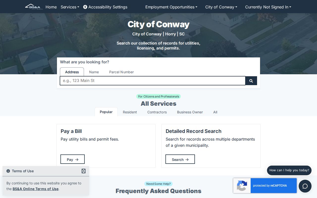
Use a confirmed PIN or address from the county trail to narrow this city search to one property question.
Conway Street Records by Address
A Conway address trail crosses several custodians, and each record has a different limit. Tax and GIS systems establish the property trail. City GIS supplies municipal context. The Register of Deeds supplies recorded-instrument leads. City BS&A can route a defined building or utility query. The table keeps the keys and limits together so a reader does not turn one narrow result into a broad personal conclusion.
| Address record | Custodian | Street-level value | Access and limit |
|---|---|---|---|
| Tax and assessment route | Horry Tax Payer Services | Name, PIN, or address entry point for a property trail. | Free account required on address-bearing county platforms. |
| Tax parcel geography | Horry County GIS | Parcel position and tax-map context. | Authorized account; tax fabric is not a survey. |
| City address and permit geography | City of Conway GIS | Addresses, centerlines, permits, and current city limits. | Map context, not a person roster. |
| Recorded land instruments | Horry Register of Deeds | Deeds, plats, mortgages, liens, and easements. | Search by document keys; name results confirmed from 1984 forward. |
| City building and utility query | City BS&A | Address, name, parcel, or record-number search route. | Result schema and coverage were not verified. |
For a current parcel question, begin at tax and GIS. For an ownership-transfer question, move to the legal description and deed chain. For municipal limits or permit geography, check City GIS first. The historical volumes themselves are covered in the Conway city directory collections, where documented years and library access are handled without confusing them with present-day parcel records.
Conway Street and Mailing Geography
A Conway mailing label is not always a City of Conway jurisdiction finding. The county’s own examples include 29526 civic-center addresses, a Conway mailing address in 29527 at the Bucksport Library, and 29528 post-office-box addresses for county offices. USPS delivery geography, municipal city limits, and county tax parcels overlap but do not mean the same thing. A property record should preserve the exact physical address, while any separate mailing address should remain a correspondence fact rather than a location conclusion.
Use USPS ZIP Code Lookup to verify a complete street address. Then compare the result with City GIS CURRENT_CITY_LIMITS and the county parcel trail. A legal description and plat are the proper bridge if an older listing seems inconsistent with the present street spelling or city boundary. No authoritative Conway-wide street-renumbering year was found, so this records workflow does not invent one.
Note: Preserve USPS formatting, municipal-limit context, and the parcel’s legal description when a Conway mailing address creates a jurisdiction question.
Older Conway Street Evidence
Historical Conway work changes sources as the date moves back. The Register’s official copy form confirms online party-name results from 1984 forward, not the beginning of Horry land records. Earlier deeds, plats, and indexes may require the Register counter, South Carolina Archives county microfilm, or the FamilySearch catalog. For a property trail, the legal description is more durable than assuming an older street listing has today’s address form.
The state historic survey documents Conway city-directory points for 1939, a 1959 through 1971 run, and 1966. It also identifies Sanborn maps for 1920, 1930, 1938, and 1949, with a digitized nine-sheet 1938 map at the Library of Congress. A map can show street and building context, while a dated directory can provide a lead. Neither source alone establishes a present connection to an address.
Conway’s county-seat history adds a second naming issue. Older research may appear under Horry District, Georgetown District, Kingston, or Conwayborough. Save book and page, legal-description, directory page, and date citations while moving between sources. Those details let the appropriate archive or county custodian test whether two historical references actually concern the same property.
Conway Street Privacy Limits
Address records are not a complete directory of people tied to a house. A tax record can show a tax or property association. A deed can show parties to an instrument. City layers can show address and permit geography. None of those sources establishes a complete list of people connected with a parcel, and a utility or permit search should not be recast as an identity search. Protected, sealed, or redacted information also remains unavailable even when related property data is public.
Lawful use. Use Conway address records for a legitimate personal, property, historical, or civic question. Do not use records to stalk, harass, intimidate, or confront anyone; South Carolina’s address-protection and harassment laws apply separately from ordinary portal access.
South Carolina’s Attorney General administers the Address Confidentiality Program under S.C. Code Ann. § 16-25-130. Eligible participants use a substitute address that state and local agencies and courts must accept. The program does not erase an already-public record, but it is a clear reason never to promise a universal address trail. For a County record that needs a focused request, use Horry County Public Information and the South Carolina FOIA process in S.C. Code Ann. title 30, chapter 4, including § 30-4-30.
Conway Street Access Routes
Online access is only one channel. The Register of Deeds offers Acclaim, its Conway counter, telephone help, and a mail copy request. Tax and GIS information may require the county’s free account after the 2026 change. City GIS is public for its mapped layers, while City BS&A supports its documented searches and city records can be sought through a narrow written request. The Clerk, Probate Court, and election offices are separate custodians when an address lead shifts into a court, estate, marriage, or election question.
For historical property context, Horry County Memorial Library’s adult resources point to the Horry County Archives Center, historical collections, newspapers, and the Independent Republic Quarterly. The Thompson Heritage and Research Library opened in Conway in January 2025 and is a practical local place to ask about identified volumes, maps, microfilm, or archive referrals. Ask for a specific date range and property or street variant, rather than a general person list.
Use the portal that holds the record, save the source date, and confirm a consequential result with that office. That approach keeps a Conway address search grounded in the record actually found.
Note: Confirm current account requirements and copy procedures with the individual Conway or Horry custodian before relying on a record.